
CHARLOTTE — We are still tracking a potential winter storm that could bring snow, rain and ice to the Carolinas on Saturday and Sunday, meteorologist Joe Puma said Tuesday. While we are still days away, confidence is increasing that something is going to happen this weekend, and it could be impactful.
>>CLICK HERE for the latest weather conditions
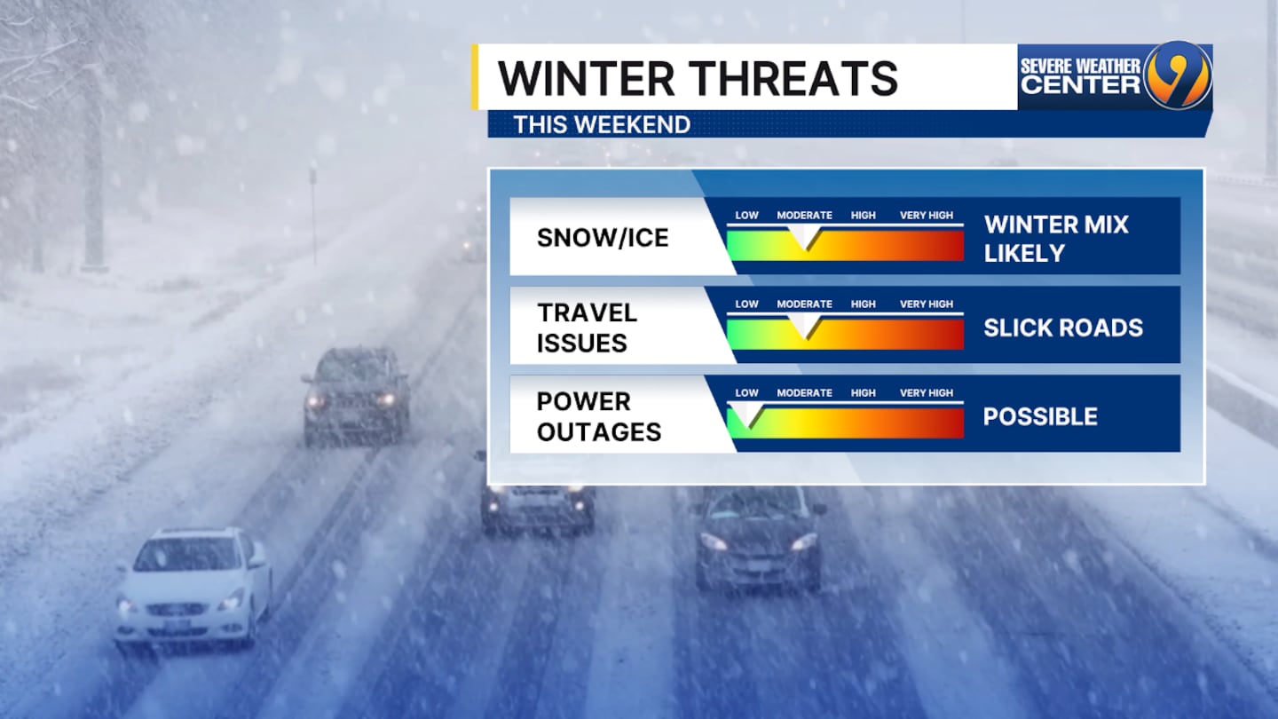
It is still too early to start talking amounts and what type of wintry weather will fall.
However, what is becoming clear is this storm will likely have impacts this weekend on the roads. We are talking slick, icy and potentially snow-packed roads.
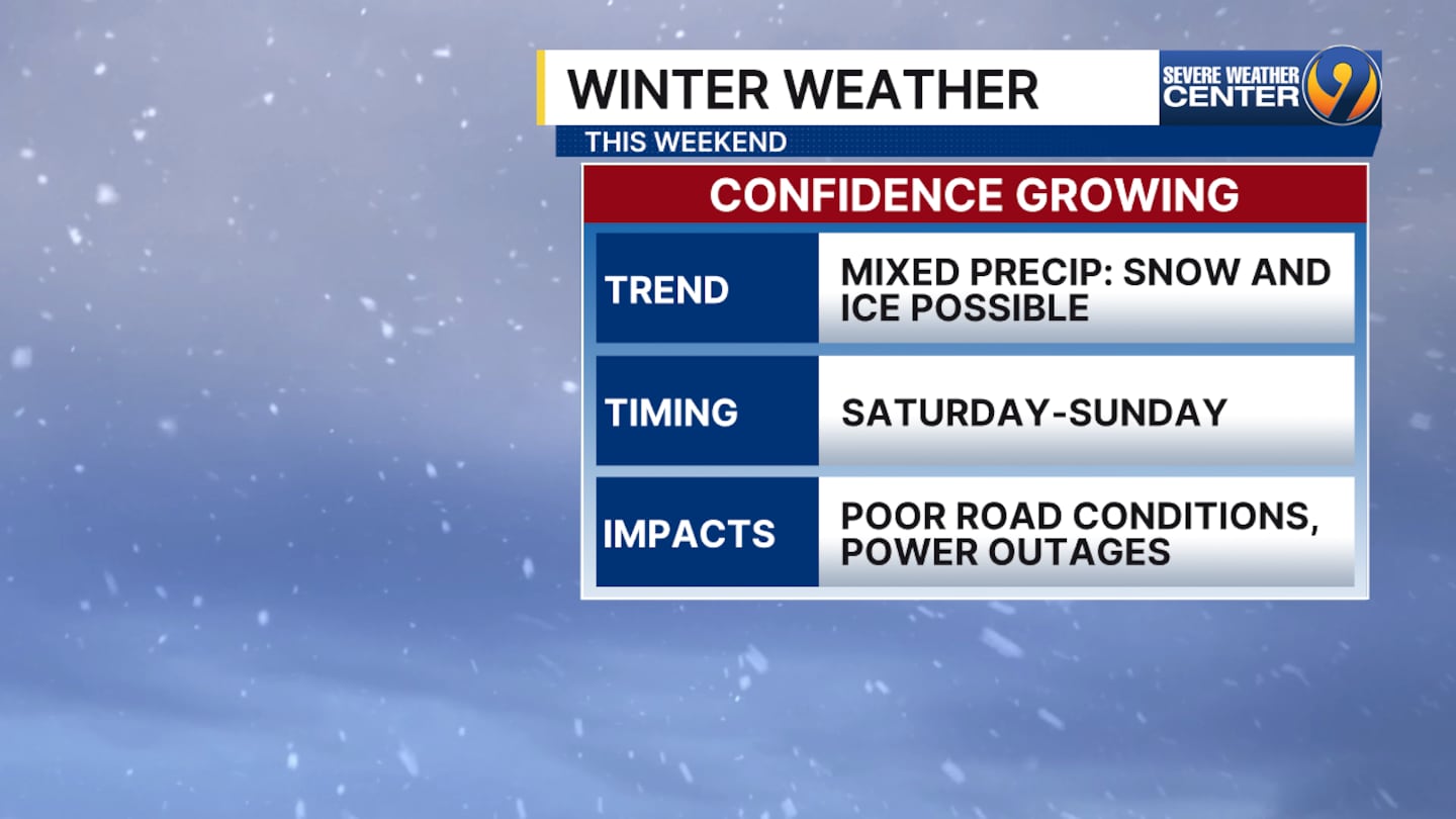
With the potential for freezing rain, we will have to watch out for isolated to widespread power outages.
Timing: Right now, both models have the bulk of this system arriving on Saturday with the snow/ice line right on Interstate 85. The snow will intensify overnight and throughout the day Sunday but could go back and forth between snow and ice especially around the metro.
Again, a lot of these finer details will have to wait until later this week. This system is still off the shore of the West Coast of the U.S. Once it moves on shore, the NWS weather balloon network will be able to get some great information that goes into our models, making it a lot more accurate. We want folks to be prepared for the potential for wintry weather and that potential is increasing right now.
VIDEO: Tuesday’s forecast
©2026 Cox Media Group

/cloudfront-us-east-1.images.arcpublishing.com/cmg/LH3JSJEF3VBLRJLJQESEAG34AM.png)


