ABOVE: The latest forecast update from Severe Weather Center 9. To stay on top of changing weather conditions, be sure to download our free WSOC-TV weather app.
FORECAST:
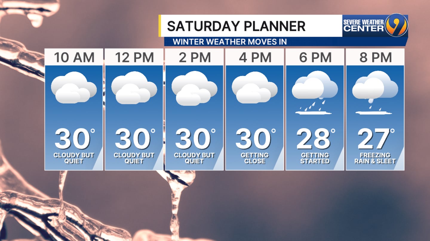
- Forecast trends continue to point toward freezing rain and sleet as the primary precipitation types later Saturday evening.
- Dry air in place will delay the onset of precipitation until late Saturday afternoon or evening, and it is also the reason overall ice totals are expected to be lower than some forecasts suggest.
- Even so, ice accumulations of around a half inch would be extremely significant and are likely to cause widespread, major impacts.
- Once precipitation begins, it is expected to persist with little interruption through midnight Monday, making this a prolonged and potentially dangerous winter weather event.
LOOKING AHEAD:
- Higher-resolution models now show the system starting later than earlier forecasts, with wintry precipitation expected to begin around or after 8 p.m. Saturday.
- Once it starts, conditions are expected to persist through Sunday night with little to no break.
>> Channel 9’s Weather 24/7 stream has the latest local weather all day, every day. Watch wherever you stream — on our website, or through your mobile app or smart TV.
WEATHER RESOURCES:
- WSOC Weather 24/7
- Interactive Radar
- Download our weather app for Severe Weather Alerts
- Hour-by-Hour Forecast
- 7-Day Forecast
FOLLOW OUR TEAM ON X:
- Chief Meteorologist John Ahrens
- Meteorologist Keith Monday
- Meteorologist Joe Puma
- Meteorologist Danielle Miller
©2026 Cox Media Group
/cloudfront-us-east-1.images.arcpublishing.com/cmg/LH3JSJEF3VBLRJLJQESEAG34AM.png)


