A second batch of a wintry mix moved out of the Charlotte area Sunday night.
ABOVE: The latest forecast update from Severe Weather Center 9. To stay on top of changing weather conditions, be sure to download our free WSOC-TV weather app.
FORECAST:
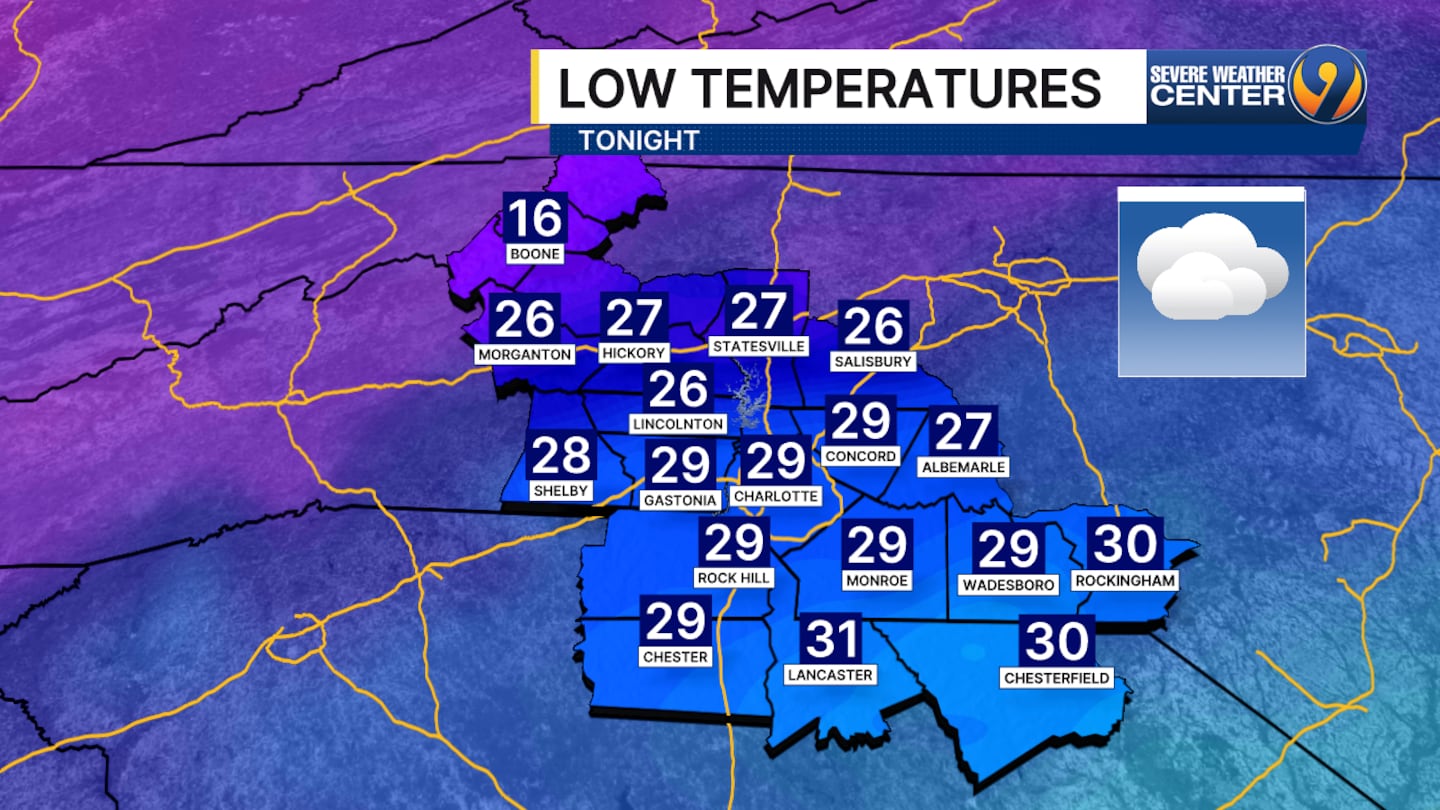
- Lows for tonight in Charlotte will be around 29 degrees with no more chances of precipitation.
- On Monday, skies will become clear with highs near 40 degrees with windy conditions and gusts up to 22 mph.
- Expect dry days and nights ahead as the bitter cold continues.
- It will get down to around 11 degrees Monday night with highs getting up to 37 on Tuesday.
- Highs will stay in the 30s for several days with lows in the teens.
- There are no chances of rain, sleet or snow through at least the weekend.
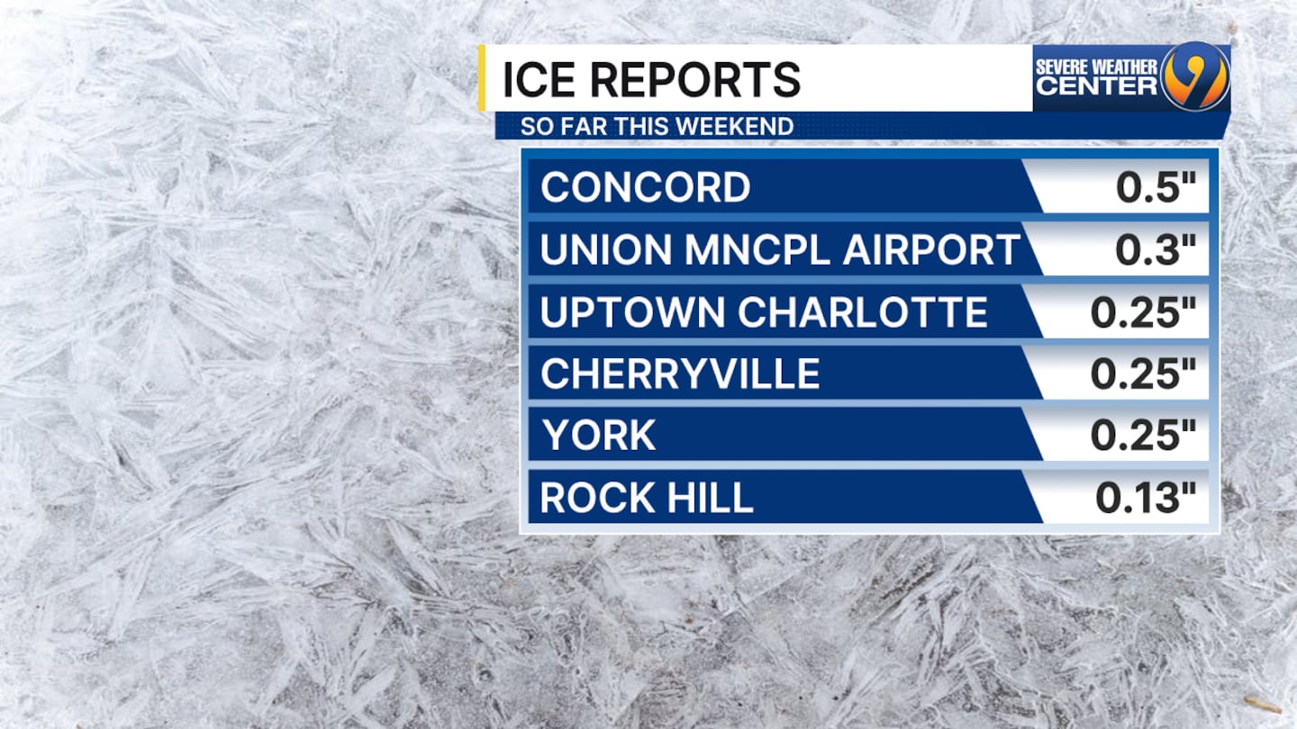
Ice totals for Sunday were up to a half inch.
>> Channel 9’s Weather 24/7 stream has the latest local weather all day, every day. Watch wherever you stream — on our website, or through your mobile app or smart TV.
WEATHER RESOURCES:
- WSOC Weather 24/7
- Interactive Radar
- Download our weather app for Severe Weather Alerts
- Hour-by-Hour Forecast
- 7-Day Forecast
FOLLOW OUR TEAM ON X:
- Chief Meteorologist John Ahrens
- Meteorologist Keith Monday
- Meteorologist Joe Puma
- Meteorologist Danielle Miller
©2026 Cox Media Group
/cloudfront-us-east-1.images.arcpublishing.com/cmg/LH3JSJEF3VBLRJLJQESEAG34AM.png)


