CHARLOTTE — You probably wouldn’t notice them, but there’s a web of sensors scattered across North Carolina. In Mecklenburg County, officials are using them to keep people safe in hurricane conditions.
We know just a few inches of rain can can cause a massive headache in Charlotte.
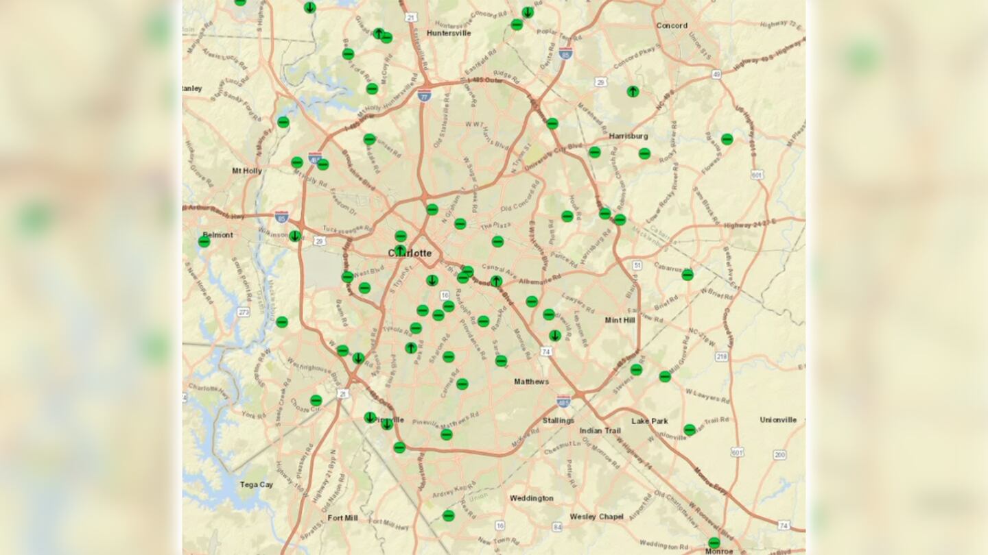
This year, North Carolina rolled out new technology to monitor how bad it may get in high-risk places like Seversville Park, an area that’s prone to getting flooded by Stewart Creek.
More than 400 water gauges have been placed across the state under bridges, pipes and culverts. Each device has a sensor that measures the water pressure and level.
The impacts from #Ian start to ramp up this afternoon and lasting well into the evening. Heavy downpours could add up to 3-4 inches in the metro with higher amounts east of I-77. Strong winds gusting over 40 mph will lead to trees down and power outages (highest risk again east.) pic.twitter.com/9oCf5oaDQN
— Keith Monday (@kmondayWSOC9) September 30, 2022
The idea started after Hurricane Florence in 2018, when we saw record flooding statewide. Anyone who lived in North Carolina then probably remembers how difficult the roads were to navigate after the storm.
At the time, the state already used the gauges, but after Florence, North Carolina leaders approved $2 million to improve them.
The difference now is that the sensors are equipped with technology to send flood information to the North Carolina Department of Transportation in real time. That helps determine when to shut down a road or even evacuate an area.
“It’s real-time information on the roadway network as the river stages increase or the coastal surge comes in,” said Matt Lauffer with NCDOT.
He added that drivers still need to be careful on flooded roads.
“Making sure you don’t drive in the water. Because even if you think the road is there, it may not be there,” Lauffer said. “If you can’t see the road, don’t even try it because the road could be gone. The pipe could be gone. And then you could be swept downstream.”
NCDOT started implementing the technology back in May, but with Ian being our first real storm this hurricane season, it’ll be the state’s first test to see how it works.
“We think ultimately it’s going to help reduce property damage, save lives and just allow us to use our resources more quickly, more rapidly and efficiently,” said Andrew Barksdale with NCDOT.
The sensors are all over Mecklenburg County, and a team of people will be monitoring the water levels throughout the weekend. NCDOT will also relay that information to local police and fire departments.

ADDITIONAL COVERAGE:
- STORM GUIDE: Preparing your family for the 2022 hurricane season
- Hurricane Ian: Here’s how you can help Florida victims
- Photos: Floridians begin assessing catastrophic Hurricane Ian damage
- ‘I thought I could die’: Floridians awaken to power outages, flooding left in Ian’s wake
- Hurricane Ian: Storm churns toward Carolina coast (live updates)
- Hurricane Ian: Photos, videos capture devastation in Florida
- School districts close, move to remote learning Friday due to expected inclement weather
(WATCH BELOW: TRACKING IAN: SC coast prepares for landfall)
©2022 Cox Media Group

/cloudfront-us-east-1.images.arcpublishing.com/cmg/LH3JSJEF3VBLRJLJQESEAG34AM.png)