RODANTHE, N.C. — Miles off the coast of the mainland of North Carolina, exposed to the fury and beauty of the Atlantic, the only constant for the Outer Banks is change.
The chain of barrier islands has been moving, growing, eroding, and reforming for millennia, but those changes don’t always coexist with the development that’s cropped up across the islands over the past several decades.
For more than 20 years, Dr. Reide Corbett, the executive director of the Coastal Studies Institute, has watched the conflict firsthand from Roanoke Island.
“Barrier islands want to change with sea level rise,” he said, “They want to change with an oncoming storm and we want to maintain the barrier islands as they are.”
Corbett has helped advise local and state officials on the changes taking place on the islands, and where those conflicts are most likely to crop up, but he said the most important part of that role, is helping them determine what is and isn’t sustainable as the Outer Banks face the combined threat of the island’s natural cycles and accelerated sea level rise due to climate change.
“We always need to be thinking about what this looks like 10 years, 20 years, 30 years down the road,” Corbett said. “We can’t continue to protect everything.”
Since the 1990s, global sea levels have risen about four inches, and NOAA estimates they will rise another 10-12 inches over the next 30 years. It may not sound like a lot, but Corbett said it will have a dramatic impact on our coastal communities. We’re already some of those impacts today.
“Not just because of that rise in sea level but you add onto that tides, you add onto that a storm surge associated with a storm or a nor’easter and the flooding that we saw ten years ago, you have to add another foot onto that,” he said.
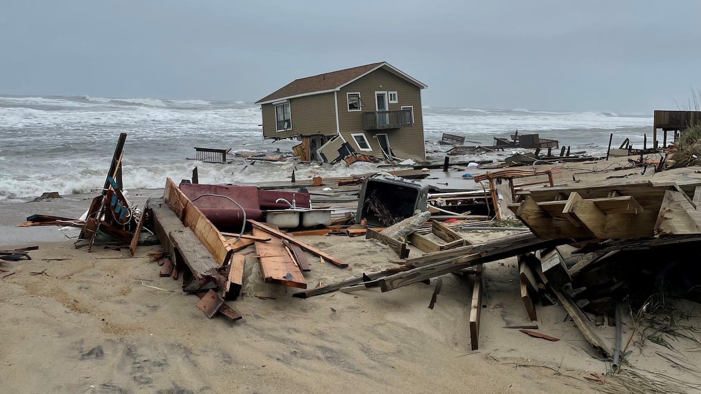
In areas like Rodanthe, which the Cape Hatteras Seashore estimates is losing about four meters of beach a year, that’s precious land locals can’t afford to lose. Several homes have been condemned as the ocean encroaches, and many have already collapsed into the water. This fall, the National Park Service has started to purchase some of those homes, hoping to demolish them before further collapses.
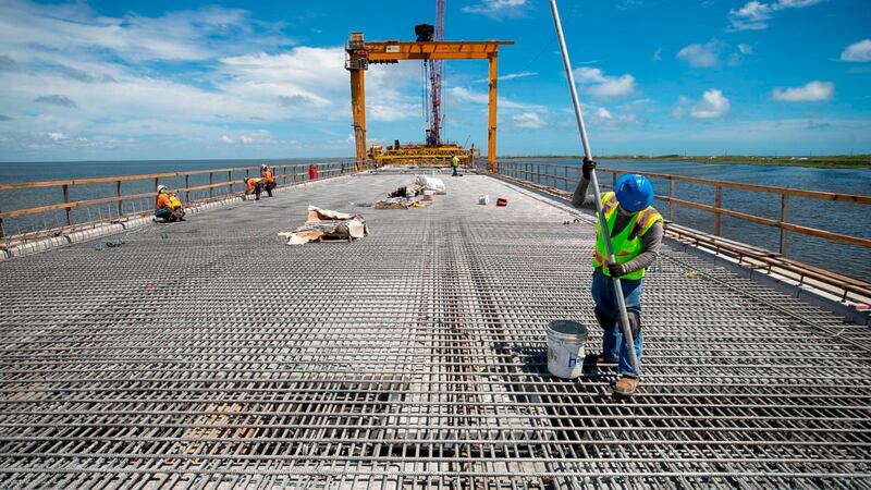
Other projects, however, are focused on ensuring iconic parts of the island survive or remain accessible; like moving the Cape Hatteras Lighthouse and building the jug handle bridge on NC 12 to bypass the most frequently closed section of roadway.
As a stakeholder on the NC 12 task force, Corbett said he’s been consulting with engineers and local officials to determine what other hot spots may continue to crop up and what potential solutions might work in the short and long term.
“We really need to focus our efforts and we should focus some of our dollars as well, in thinking about what’s most vulnerable today,” he said. “Where do we need to back off the front line and where do we need to look at some of those important transportation corridors?”
This is the first of four stories in a series about sea level rise and its impact on the NC Coast. Future stories will look into efforts to keep NC 12 safe and open, the impact of saltwater intrusion on the mainland and experiments off the coast of the Outer Banks that could help combat climate change.
(WATCH: Bridge designed to avoid flooded road to Outer Banks opens on NC coast)
©2023 Cox Media Group

/cloudfront-us-east-1.images.arcpublishing.com/cmg/LH3JSJEF3VBLRJLJQESEAG34AM.png)