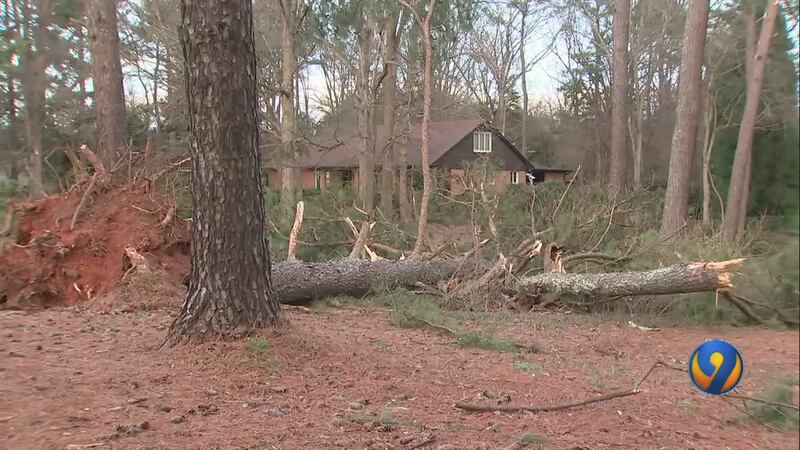
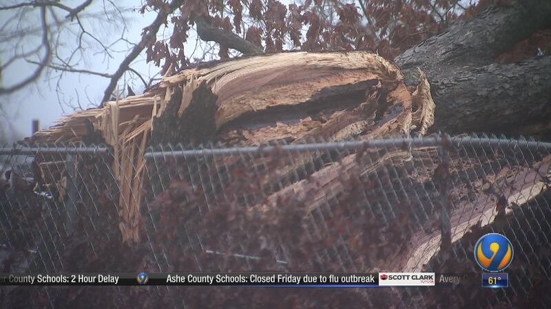
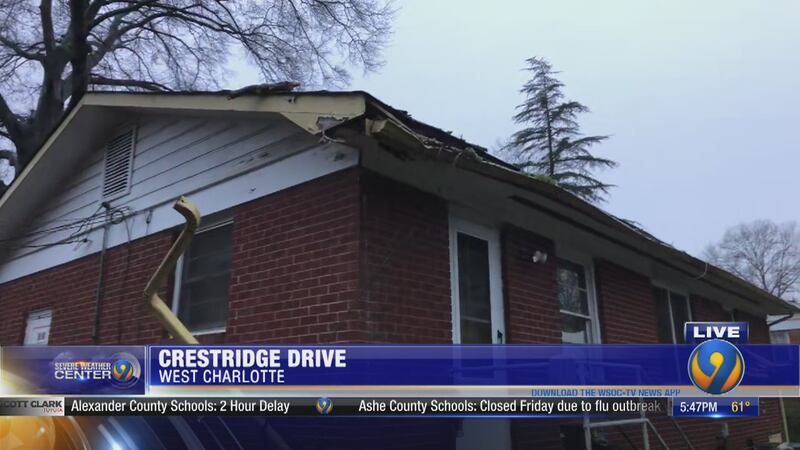
CHARLOTTE — Roofs ripped off, trees on homes and debris scattered for miles -- Chopper 9 Skyzoom flew over some of the area’s hardest-hit neighborhoods on Saturday as the people who live there shift into recovery mode.
The National Weather Service confirmed six tornadoes touched down in the Charlotte region during Thursday’s storms.
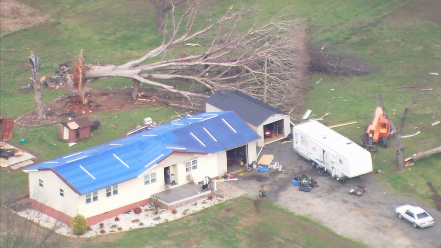
Damage from @WSOCChopper9 first two photos are Cabarrus County East of Kannapolis. Photos 3 and 4 are Stanly County around Millingport Rd. @wsoctv @WSOCWeather @JaclynWSOC9 pic.twitter.com/X7DNNcqYGx
— Blaine Tolison (@BTolisonWSOC9) February 8, 2020
There was widespread damage across our area Thursday as severe storms whipped through the region.
On a two-and-a-half-hour flight in Chopper 9, Eyewitness News anchor Blaine Tolison followed the path of several of the tornadoes. First in Cabarrus County, over Old Salisbury Concord Road, our crew followed the path of an EF-2 tornado. We could see several homes missing a roof, families moving belongings out of damaged homes and trees snapped like twigs.
In Stanly County, around Millingport Road, we surveyed damage from an EF-1 tornado.
0 of 26


A mobile home was seen moved off of its foundation and around another mobile home, a shed looked like it exploded.
From Matthews to Pineville, our crew followed the path of an EF-1 tornado. We found the roof of a building supply company near downtown Matthews ripped away.
Off Highway 51, crews could be seen climbing a tree that crushed the roof of a home and off Alexander Road, we saw a home missing so much of its roof, we could see the people working inside.
You can report damage at the below links:
National Weather Service confirms 6 tornadoes touched down Thursday
Cleveland County/Lincoln County tornado
- Start time: 9:47 a.m.
- EF-Scale: EF1
- Maximum wind speed: 100 mph
- Path length: 7.54 miles
The National Weather Service has confirmed an EF-1 tornado touched down in Cleveland County. Officials said it developed in the Lawndale area, near West Stage Coach Trail and Church View Drive.
It then tracked northeast, crossing Hicks Hill Road, Casar Lawndale Road and New Bethel Church Road.
According to officials, most of the damage was to snapped and uprooted trees. They said a mobile home had minor roof damage and an outbuilding was destroyed.
It continued to cross the area, hitting Will Dixon Road, Warlick Road and Highway 18, north of Fallston.
The tornado weakened and ended shortly after passing into Lincoln County, near Hull Road.
Mecklenburg/Union County tornado
- Start time: 12:18 p.m.
- EF-Scale: EF1
- Maximum wind speed: 95 mph
- Path length: 17 miles
The National Weather Service confirmed an EF-1 tornado touched down just before 12:30 p.m. along Nations Ford Road on the state line in Pineville.
According to officials, most of the damage was to trees and structural damage on Industrial Drive, west of Interstate 485. Wind speeds were between 90 and 95 mph.
The tornado maintained its strength as it crossed the interstate and stretched on the ground for 17 miles from Pineville to Matthews.
Officials said it traveled across mostly residential areas in southern Mecklenburg County, tearing up trees in its path. At least one tree fell on a house in the area.
Larger trees were damaged along Highway 51 in Matthews, east of Elizabeth Lane Elementary School.
The tornado weakened but caused more damage to trees on West John Street, closer to downtown Matthews.
Then, the tornado crossed East Independence Boulevard and I-485 into Union County.
It ended near Hawthorne Drive in Indian Trail.
Officials said it lasted around 16 minutes and no injuries were reported.
Kannapolis, Cabarrus County, Rowan County tornado
- Start time: 11:45 a.m.
- EF-Scale: EF2
- Maximum wind speed: 125 mph
- Path length: 6.4 miles
The tornado started at 11:45 a.m., west of Interstate 85 near Lane Street, according to the National Weather Service. It crossed I-85 and moved east along Old Salisbury-Concord Road until it reached Gold Fish Road.
The tornado then moved east along Irish Potato Road until it crossed Buffalo Creek.
The worst damage was seen east along Pless Road, where homes were damaged.
The tornado weakened and ended near Sisk-Carter Road. No injuries were reported.
Cleveland County, Gaston County tornado
- Start time: 10:55 a.m.
- EF-Scale: EF2
- Maximum wind speed: 130 mph
- Path length: 8.6 miles
The tornado began near the intersection of Battleground Road and I-85 in Cleveland County, the National Weather Service said.
It moved east near the intersection of Dixon School and Bethlehem roads. The worst damage was east of the intersection where a couple of electrical transmission towers were blown down.

The tornado weakened as it moved east and crossed York Road at the Gaston County line.
The damage ended near Freedom Mill Road. The tornado lasted about 10 minutes and no injuries were reported.
Rowan County near Gold Hill tornado
· Start time: 11:56 a.m.
· EF-Scale: EF0
· Maximum wind speed: 85 mph
· Path length: 1.5 miles
The tornado developed near the intersection of Old Beatty Ford and St. Stephens Church roads, south of Gold Hill.
It moved along Old Beatty Ford Road and ended at the intersection with Old U.S. Highway 80.
NWS: Confirmed EF-1 tornado in pineville just near the state line.
— Jaclyn Shearer (@JaclynWSOC9) February 7, 2020
Most damage was tree damage
Structural damage on industrial drive
Stanly County tornado
· Start time: 12:42 p.m.
· EF-Scale: EF1
· Maximum wind speed: 110 mph
· Path length: 7.3 miles
@NWSRaleigh storm surveys found EF-1 tornado damage from yesterday's storms in both Randolph and Stanly Counties. Thankfully no one was injured! Special thanks goes out to @RandolphCoES and @StanlyCountyNC EM Services. Visit https://t.co/RuDsotKuCT for more details. #NCwx pic.twitter.com/zTqgp95aaI
— NWS Raleigh (@NWSRaleigh) February 8, 2020
In Matthews, downed power lines shut off power for hours, and crews worked through the night to repair the damage.
It was a storm resident Brett Kiker will not forget.
"I was right upstairs,” Kiker said. “It got very loud and windy and rained. I just kind of sat in the middle of the room and waited for it to pass."
The damage may have been caused by a tornado, which was the same one that appeared to get picked up on our radar in Pineville minutes earlier.
“Then you see the swirling winds coming right through the parking lot and debris just flying everywhere,” said Damon Barron, a lumberyard owner.
The fire chief is convinced a tornado touched down in Matthews. Officials have not confirmed that a tornado did touch down in Matthews.
0 of 32


The storm affected every county in our viewing area.
Scaffolding carried away in the wind outside an uptown Charlotte restaurant sending customers scrambling.
Tornado warnings forced students to duck for cover in the hallways of their schools before some districts let classes out early.
Windows shattered, trees snapped, and a bathtub was found in someone’s yard after a possible tornado tore through Kannapolis.

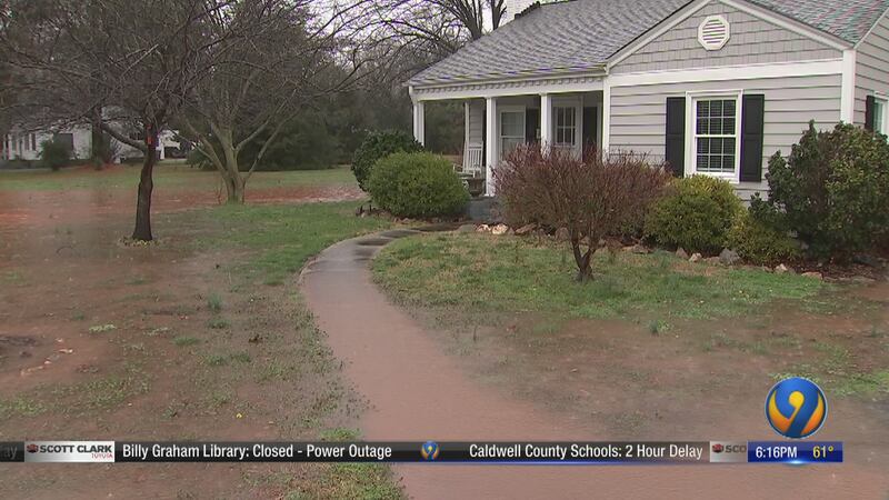
Heavy rainfall caused flooding throughout the area that shut down roads, caused voluntary evacuations and forced school districts to close or open late Friday.
On this webpage, we have team coverage from the hardest-hit areas.

© 2020 Cox Media Group
/cloudfront-us-east-1.images.arcpublishing.com/cmg/LH3JSJEF3VBLRJLJQESEAG34AM.png)