CHARLOTTE — Tropical Storm Erin is moving west through the Atlantic Ocean and is expected to strengthen into the first hurricane of this season. In fact, the storm could reach major hurricane status by late this weekend.
>>>LINK: WSOC’s Tracking the Tropics page
The current forecast track keeps the storm north of the Virgin Islands and Puerto Rico through the weekend. Swells generated from Erin could affect these areas this weekend and cause life-threatening surf and rip current conditions, according to the National Hurricane Center.
Eary next week Erin will make a turn to the north thanks to the Bermuda High and a cold front helping to change the storm’s path. This current forecast does keep the storm away from the East Coast, though we’ll have a clearer idea of it’s exact path by the weekend.
Tracking #Erin: The tropical storm is strengthening and could be a major hurricane by the weekend as it tracks north of the Virgin Islands. We're expecting it to make a turn north early next week. More details to come on exactly where it turns as we get more guidance! pic.twitter.com/sYiDUQDf1e
— Danielle Miller (@wx_danielle) August 13, 2025
Currently, direct impacts are not in the forecast for the continental United States, however, beachgoers will need to be on guard. There will be an elevated rip current risk from Florida, to the Carolinas, and the North East next week as Erin churns just off the coast.
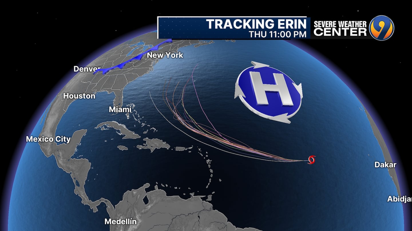
We’ll have more specific details on these impacts over the next few days as more model guidance comes in and Erin strengthens.
VIDEO: Tropical Storm Erin forms in the Atlantic

©2025 Cox Media Group

/cloudfront-us-east-1.images.arcpublishing.com/cmg/LH3JSJEF3VBLRJLJQESEAG34AM.png)


