ABOVE: The latest forecast update from Severe Weather Center 9. To stay on top of changing weather conditions, be sure to download our free WSOC-TV weather app.
FORECAST:
- We have some storms actually moving through the foothills right now with heavy rainfall.
- This is our arctic front that will bring a major drop in temperatures. Today we are in the middle to upper 70s, tomorrow we will be in the upper 40s.
- A drop of nearly 30 degrees. We could see some snow showers in the high country.
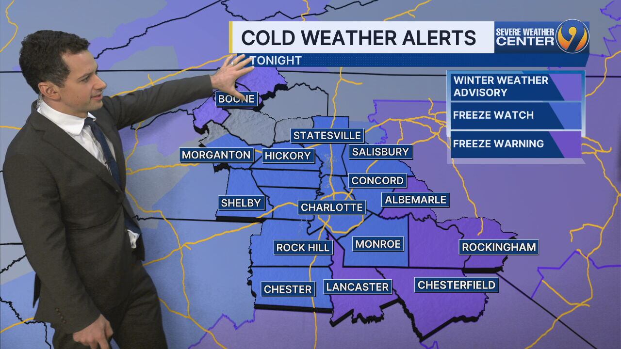
- We do have several alerts up for tomorrow’s cold air. Lows Monday night will drop into the 20s with widespread killing freeze likely.
- Wind chills will be in the teens Tuesday Morning.
- Thankfully, our cold snap doesn’t last long we are back in the upper 60s by next weekend.
- FREEZE WATCH for the entire region from 8 PM Monday to 8 AM Tuesday Overnight temps in the 20s
- WINTER WEATHER ADVISORY for Ashe County up to 3 inches of snow at the high elevations, winds gusting to 45 mph at times, low wind chills
- Could tie record low on Tuesday at 26 degrees
- Back to the 60s by Wednesday
>> Channel 9’s Weather 24/7 stream has the latest local weather all day, every day. Watch wherever you stream — on our website, or through your mobile app or smart TV.
WEATHER RESOURCES:
- WSOC Weather 24/7
- Interactive Radar
- Download our weather app for Severe Weather Alerts
- Hour-by-Hour Forecast
- 7-Day Forecast
FOLLOW OUR TEAM ON X:
- Chief Meteorologist John Ahrens
- Meteorologist Keith Monday
- Meteorologist Joe Puma
- Meteorologist Danielle Miller
©2025 Cox Media Group
/cloudfront-us-east-1.images.arcpublishing.com/cmg/LH3JSJEF3VBLRJLJQESEAG34AM.png)