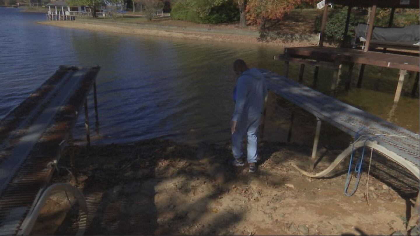
KINGS MOUNTAIN, N.C. — Ahead of the first freeze, Donyell McCluney knew he had to get his boat out of Moss Lake and stored for the winter.
The issue was that his boat was deeper in the lakebed than the actual lake.
“I haven’t taken it out in over a month because it was stuck,” he said.
For the third fall in a row, western North Carolina and much of northwestern South Carolina are experiencing drought conditions. All of the Charlotte metro area is under moderate drought designation, with the exception of Cleveland and Gaston counties. Those two counties are in severe drought.
According to Kings Mountain Water Resources, the dry conditions have put Moss Lake two feet, eight inches below full. The drop is severe enough to close six of the ten public ramps. For McCluney, it means the water is low enough that his entire pier is out of the water.
“Never seen it this low,” he said.
Dry fall seasons are nothing new in the Carolinas. According to Corey Davis, an assistant state climatologist for the NC Climate Office, said that the region is coming off of three consecutive years in a La Niña weather pattern, which tend to lead to dry conditions in the south. The issues start when those dry periods stretch out and add up.
“We still need .75 of an inch or so of rain per week this time of the year and when we look at what we’ve gotten in the last few weeks and in the month of October, it’s not even been close to that,” he said. “We’re now seeing deficits in some places of four, five, six inches, that can’t be overcome with one rain event.”
On Thursday, the Catawba-Wateree Water Management Group announced the basin is in stage one of the group’s low inflow protocol. That’s prompting a call for dozens of municipalities to voluntarily reduce water usage by 5% and adjust hydroelectric operations along its dams.
According to Duke Energy’s lake level measurements, Lake Norman and Lake Wylie are both about two and a half feet below target levels.
Fortunately, Davis said the Carolinas are in a better position than much of the south. Well-timed rain events and tropical systems have prevented years-long precipitation deficits like the states saw in 1998-2002, the last time there were three consecutive La Niña years.
There is also a silver lining in that this dry period comes at a time when most farms are harvesting rather than planting, and water use is lower than it would be during the summer. Unfortunately, North Carolina’s drought coincides with fire season in the mountains.
“When the leaves start falling off the trees and those accumulate on the ground, all of those leaves are a really flammable, really ready source for fires,” Davis said.
Relief should be coming soon though. Winter is bringing an El Niño pattern, which typically brings wet weather to the southeast. Davis said increased precipitation could start as early as late November but will certainly come before spring.
“By January is typically when we see those most pronounced impacts,” he said.
Looking at the long-term trends, Davis said paradoxically, the Carolinas seem to be getting wetter and drier at the same time, experiencing more “flash” events bringing sudden strong downpours as well as droughts.
“The old saying goes, when it rains it pours and that’s what we’re seeing here in North Carolina,” he said. “Those wet times are getting even wetter and we’re seeing longer gaps between rain events.”
(WATCH: Drought reveals dinosaur footprints from 113 million years ago)
©2023 Cox Media Group

/cloudfront-us-east-1.images.arcpublishing.com/cmg/LH3JSJEF3VBLRJLJQESEAG34AM.png)


