MOUNTAIN ISLAND, N.C. — The National Weather Service has issued extended the flood warning for Mountain Island Lake, affecting northeastern Gaston County and northwestern Mecklenburg County through Monday, June 10 at 7:45 p.m.
Duke Energy, which manages the lake, said it expected the lake to crest at higher than 106 feet. That came true, as the river crested Monday morning at just shy of 107 feet.
The record for the lake was set in 1940 at 109.6 feet, and Monday's levels were the second highest in recorded history.
In addition, significant releases of water at Cowans Ford Dam are continuing to cause flooding along the Catawba River downstream.
According to the Gaston County Emergency Management Office, lake levels at 105 feet or higher will cause flooding of lake access areas and docks in the Nivens Cove and Stonewater Bay communities.
FULL COVERAGE:
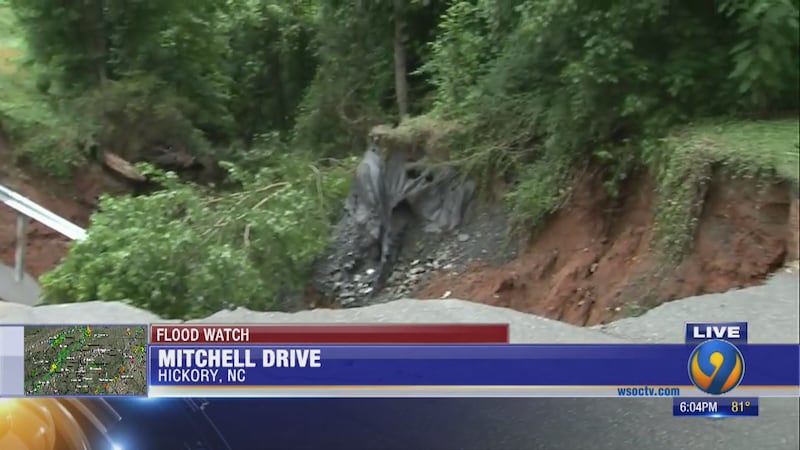
- Residents forced to evacuate from Hickory apartment complex due to flooding
- Catawba, Caldwell counties declare State of Emergency after days of heavy rain
- Good Samaritans wade into floodwaters to save trapped fawn
- Names of victims released in Lincolnton car crash into creek
- Burke County nursing home staff moved after water enters building
Gaston County Emergency Management is warning residents in low-lying areas to be on the alert – particularly those living along the shores of the Catawba River.
The NWS said additional heavy rainfall through Wednesday could continue to cause high water level issues.
Charlotte Mecklenburg Emergency Management is recommending residents who live along Riverside Drive along the Catawba River should evacuate.The American Red Cross has set up a shelter at Hopewell High School in Huntersville for residents that need to leave their homes.
Rescue crews brought families to safety in northwest Charlotte. Families could be seen dragging what they could to dry land.
Channel 9 was there as Charlotte firefighters rescued a husband and wife, 87 and 89 years old, and their dog from their flooded home. Their daughter said she was so grateful they made it out OK.
The Charlotte Fire Department said they rescued 34 people overnight. Officials said there are about 12 people that are staying at the emergency shelter at Hopewell High School.
Sherry Rutledge, who said her daughter had to be rescued, said flooding does happen in the area, but it is so infrequent, they never thought it would reach them.
"We don't have flood insurance," Rutledge said. "My mom canceled it years ago because the house never flooded. Never ever ever flooded and it was built in the 70s."
Rutledge said she was on the phone with her daughter Sunday night when firefighters were on their way to get her.
"Finally she said, 'Mom, it's underneath the windows. I can see things floating past the house,'" Rutledge said. "It was halfway up her calf then."
Channel 9's Gina Esposito spoke with evacuee Thomas Gunter, who said his house sits up on a hill and his family still had to evacuate. He said he is concerned the homes below have six to eight feet of water inside.
"We never had water in our house before, in 30 years, all of sudden, we got an inch of water inside our home, and 3 feet in our garage," Gunter said. "It's a mess."
Gaston County Emergency Management has not ordered any evacuations yet. They are warning people to stay off the water due to the rapid current.
Additionally, the National Weather Service extended the flood warning for the South Fork River at Lowell until the morning of Wednesday, June 12.
The Lowell gauge read 14.4 feet as of 4 p.m. Monday, putting it in moderate flood stage. It is expected to crest late Monday just shy of major flood stage.
Gaston County Emergency Management said this could affect areas in Cramerton and Goat Island Park in Lowell. Parts of McAdenville and Dallas close to the river could also be affected.
Read more top trending stories on wsoctv.com:
- Stanly Co. sheriff: Suspect charged after 19-year-old woman dies from severe beating
- Some residents along Catawba River begin to evacuate homes as rain continues
- 'I heard my wife screaming': Tree crushes west Charlotte home, traps nearby residents
- FORECAST: Flood threat remains as Charlotte region enters day 4 of rain
- Car show participants have cars stolen from hotel parking lot in north Charlotte
Cox Media Group

/cloudfront-us-east-1.images.arcpublishing.com/cmg/LH3JSJEF3VBLRJLJQESEAG34AM.png)


